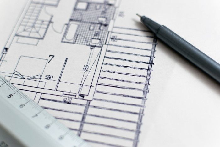
One of the most important elements of a planning application is the plans that support the application. Getting these plans right at the start can save a lot of time. It allows planning officers to effectively assess the planning application.
There are several different plans that can support a planning application. However, the following plans are the basic ‘building blocks’ for a planning application.
Survey or site context plan
A survey or site context plan clearly shows the boundaries and measurements of the land. It includes the position of any structures relative to where the boundaries are located. It should also include neighbouring properties and structures.
A licensed professional, known as a 'land surveyor', prepares this plan. They visit the land and take precise measurements using special equipment.
Site plans
A site plan precisely maps out the area of a parcel of land and any buildings to scale.
Usually, there are two site plans you should provide:
- existing site plan – the ‘before’. This site plan shows the site in its current state.
- proposed site plan – the ‘after’. This site plan shows what will change and how the site will look once construction is finished.
Site plans should be drawn to scale, preferably 1:100, 1:200 or 1:500.
Site plans should include location information, such as:
- a North point
- boundaries, dimensions and orientation of the site
- the streets that adjoin the property
- all adjoining properties, including details of the use, location of buildings, access ways and other significant features
- where the habitable room windows are that face the property
- where the secluded open space areas are surrounding the site
- the area the proposed development will cover
- the exact location and footprint of any existing structures on the site.
Site plans need to show features in front of the site. It should note things that might affect access to the site or construction such as:
- electricity poles
- street trees
- drainage pits
- fire hydrants
- vehicle crossings, etc.
Other details a site plan should contain include:
- relevant ground levels within the site and on adjacent properties measured to the Australian Height Datum (AHD)
- all easements, drainage and sewerage pipes, and power lines
- features such as footpaths for public and private areas, areas set aside for outdoor storage and service facilities such as plant equipment
- all driveways, parking spaces, visitor parking, loading bay areas, bicycle parking areas and pedestrian accessways, including construction details
- vegetation to be removed or retained on the site
- areas not required for use straight away.
Elevation plans
An elevation plan should be drawn to scale (preferably 1:100) and should show how all sides of a building or structure will look. It should include:
- the relationship of the elevations to natural ground level, showing any proposed cut or fill
- natural ground level, finished ground level, finished floor level and overall building height to the Australian Height Datum (AHD)
- external wall heights (above natural ground level)
- overall building heights (above natural ground level)
- colours, materials and finishes of all external surfaces.
Floor plans
A floor plan is a diagram drawn to scale and viewed from above. It shows the layout of the buildings and setbacks to the site boundaries.
A floor plan should include:
- the location and dimensions of walls, windows and doors
- the proposed use of each room or area within the building
- the floor area of each room.
Shadow diagrams
A shadow diagram is an outline of the site and surrounding properties that shows the shadows that the proposed buildings and structures next to it will cast at different times of the year. For example, at 9am and 3pm at the September equinox.
Landscape plans
A landscape plan shows all proposed soft and hard landscaping elements and materials, including:
- the natural and finished surface levels of the land, including any proposed retaining walls
- existing vegetation to be retained and removed (you must submit an Arboricultural Assessment if you are removing native vegetation)
- details of ground covers, including mulch and lawn areas
- method of preparing, draining, watering and maintaining the landscaped areas
- the extent of any earthworks
The plan must also contain species of individual plantings, including:
- their botanical name and common name
- mature height and spread
- pot size
- purchase height (if the plant is a tree)
- individual plant quantities.
Landscape plans should also show the location of existing trees, grassed areas and other landscape features on the site.
Garden area plan
A garden area plan is a site plan that includes a hatched or shaded area that provides the percentage of the site not covered by buildings, driveways or any other structures.
Other documents you might need
Depending on the type of application and what is being proposed, you may need to submit other documents. Refer to our planning information guides and checklists for guidelines on the specific information you may need to submit, such as:
- traffic and transport assessment
- waste management plan
- environmentally sustainable design (ESD) report
- arboricultural report, etc.
Sustainable design requirements for planning applications
You may need to address and report on Environmentally Sustainable Design (ESD) issues as part of the planning permit application process. This will depend on the size and type of development. An ESD report must outline how your development will deliver a sustainable outcome to its occupants and the environment.
Council uses the Sustainable Design Assessment in the Planning Process (SDAPP) program. This ensures you address the ESD requirements.
Find out more about Council’s sustainability reporting requirements.
Visit the Planning Service Counter.